Floodplain Management
Floodplain management is the operation of a community program of preventive and corrective measures to reduce the risk of current and future flooding, resulting in a more resilient community. These measures take a variety of forms, are carried out by multiple stakeholders with a vested interest in responsible floodplain management and generally include requirements for zoning, subdivision or building, building codes and special-purpose floodplain ordinances.
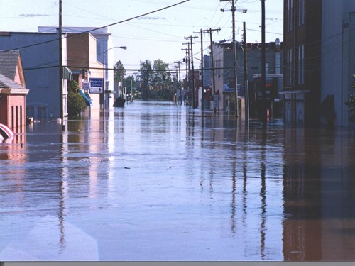
The City of Franklin is committed to assisting all property owners and citizens who have questions about the floodplain, floodplain regulations, and reducing flood hazard risks. Should you have questions about flood maps, floodplain regulation, building in the floodplain, or how you can better prepare for flooding, please visit the City of Franklin Department of Community Development located at 207 West Second Avenue, Franklin, Virginia 23851 or by calling 757-562-4515 or by emailing crsmith@franklinva.com.
While FEMA has minimum floodplain management standards for communities participating in the National Flood Insurance Program (NFIP), adopting higher standards will lead to safer, stronger, more resilient communities. FEMA’s Floodplain Management Branch provides tools and resources to help communities navigate NFIP requirements and implement higher standards of floodplain management. State and federal agencies, local communities and property owners have a role in reducing flood risk and helping communities become more resilient. From states providing strong model ordinances, to communities adopting and enforcing higher-standard building practices, to property owners elevating their homes, everyone can play a part in making communities safer and more resistant to flood disasters.
For more information on flood insurance, visit FloodSmart.gov.
For more information on flood maps and to determine the flood risk of your property, take a look at the Franklin FIRM Panels or Southampton FIRM Panels, visit FEMA Flood Map Service Center, or turn on the floodplain layer on the Franklin GIS Viewer or Southampton GIS Viewer map.
Information on Building or Rebuilding in the Floodplain
The Office of the Flood Insurance Advocate is available to the public and staffed by National Flood Insurance Program professionals who are experts in all aspects of the NFIP, including claims processes, the map review and amendment process, floodplain management, and flood mitigation techniques and resources. If you have any questions, click on the link below:
https://www.fema.gov/webform/flood-insurance-advocate-ask-question